Register Login
Wish List (0) My Account Shopping Cart Checkout
Register Login
  • Wish List (0)
  • My Account
  • Shopping Cart
  • Checkout
GPSForestry Solusi
 

Free shipping

all order over $150
 

Return & Exchange

in 3 working days
 

021 53167044

Contact us by phone

View Cart

0 item(s) - Rp.0
  • Your shopping cart is empty!

Categories
  • BRANDS
  • CONSTRUCTION LASERS
  • FORESTRY EQUIPMENT
  • SURVEYING EQUIPMENT
  • WATER QUALITY
  • WEATHERS
  • INSPECTIONS
  • HYDROLOGY
  • SAMPLING

Special

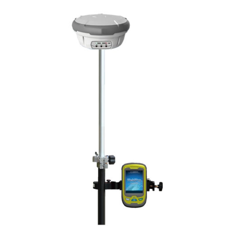
  • Smart Max Geosystem M8 GNSS RTK Base and Rover with External Radio and Field Genius8
Smart Max Geosystem M8 GNSS RTK Base and Rover with External Radio and Field Genius8
Smart Max Geosystem M8 GNSS RTK Base and Rover with External Radio and Field Genius8 Smart Max Geosystem M8 GNSS RTK Base and Rover with External Radio and Field Genius8

Smart Max Geosystem M8 GNSS RTK Base and Rover with External Radio and Field Genius8

  • Brand: Smart Max Geosystems
  • Product Code: SMG-M8-001
  • Availability: 10 - 14 Working Days
  • Rp.145,500,000
Qty
Add to Wish List
Compare this Product

0 reviews / Write a review

Tags: Smart Max Geosystem, Single-Frequency, Thermal Printer, Echosounder

  • Description
  • Reviews (0)

M8 is a high-accuracy multi-frequency multi-satellite RTK intelligent mapping system, applying to different fields such as electric power, transportation, agriculture, forestry, national land. With advanced positioning technologies, it can track all visible GPS, GLONASS, COMPASS satellite signals very fast and keep in a stable performance, so as to achieve accurate, effective, reliable RTK survey. 
Based on the self-developed software, its powerful GIS function enables M8 to collect GIS data but in RTK high accuracy. Furthermore, the 1GB high-speed processor in PDA and the strong kernel of the software make it easy to load 10GB image or hundred MB vector map as background, which make M8 to be a perfect for your field survey work.


Features:

- Support GPS、GLONASS、Compass、Galileo

- Support WASS、EGNOS、MSAS、GAGAN

- Fast initialization and satellite tracking technology

- Seamless compatible with various CORS/VRS system

- Stable 1cm(horizontal) RTK

- 2.5mm±1ppm (horizontal) for post-processing accuracy for long baseline static network 

- Powerful self-developed software makes GNSS RTK+GIS collection in one

- 1GB high-speed processor in PDA and strong software kernel, enable 10GB image or hundred MB

  vector map as background loading very fast 

- Dual power supply + assistant battery design, the largest battery capacity in the field, supporting at

  least 12 hours continuous CORS RTK or 18 hours static survey

- Built-in transmitting and receiving UHF, 3G/GSM, Bluetooth

- Multiple data storage: internal NANDFLASH and MicroSD, external USB port for U disc extension

  (up   to 64G)

- One key base setup

- Completely exchangeable base and rover

- Intelligent error diagnosis and voice broadcast function


What's in the Box:

- (1) Smart Max Geosystem M8 GNSS RTK Base and Rover with External Radio and Field Genius8

- (1) Manual


Brochure/Datasheet

Instruction manual


Catatan: Harga tidak mengikat, sewaktu waktu bisa berubah tanpa pemberitahuan dahulu

    Write a review

    Write a review

    Note: HTML is not translated!
        Bad           Good

    Newsletter

    Email Newsletter Promo www.gpsforestry-suppliers.com and you will be one of the first users to search about our various promos, offers and discounts. .

    Order online

    Phone: +123 456 789

    Fax: +123 456 789

    Email: admin@admin.com

    Stay Connected

    •  Facebook
    •  Twitter
    •  Google +
    •  Youtube
    •  RSS Feed

    Customer Service

    • Contact Us
    • Returns
    • Site Map
    • Brands
    • Gift Vouchers

    My Account

    • My Account
    • Order History
    • Wish List
    • Newsletter
    • Specials
    Powered By Indomultimeter
    GPSForestry Solusi © 2025. Design By Indomultimeter

    Categories
    • BRANDS
    • CONSTRUCTION LASERS
    • FORESTRY EQUIPMENT
    • SURVEYING EQUIPMENT
    • WATER QUALITY
    • WEATHERS
    • INSPECTIONS
    • HYDROLOGY
    • SAMPLING